- Chronology
- Before 1500 BCE
- 1500 BCE to 500 BCE
- 500 BCE to 500 CE
- Sixth to Tenth Century
- Eleventh to Fourteenth Century
- Fifteenth Century
- Sixteenth Century
- Seventeenth Century
- Eighteenth Century
- Nineteenth Century
- Twentieth Century
- Twenty-first Century
- Geographic Area
- Africa
- Caribbean
- Central America
- Central and North Asia
- East Asia
- North America
- Northern Europe
- Oceania/Australia
- South America
- South Asia/South East Asia
- Southern Europe and Mediterranean
- West Asia
- Subject, Genre, Media, Artistic Practice
- Aesthetics
- African American/African Diaspora
- Ancient Egyptian/Near Eastern Art
- Ancient Greek/Roman Art
- Architectural History/Urbanism/Historic Preservation
- Art Education/Pedagogy/Art Therapy
- Art of the Ancient Americas
- Artistic Practice/Creativity
- Asian American/Asian Diaspora
- Ceramics/Metals/Fiber Arts/Glass
- Colonial and Modern Latin America
- Comparative
- Conceptual Art
- Decorative Arts
- Design History
- Digital Media/New Media/Web-Based Media
- Digital Scholarship/History
- Drawings/Prints/Work on Paper/Artistc Practice
- Fiber Arts and Textiles
- Film/Video/Animation
- Folk Art/Vernacular Art
- Genders/Sexualities/Feminisms
- Graphic/Industrial/Object Design
- Indigenous Peoples
- Installation/Environmental Art
- Islamic Art
- Latinx
- Material Culture
- Multimedia/Intermedia
- Museum Practice/Museum Studies/Curatorial Studies/Arts Administration
- Native American/First Nations
- Painting
- Patronage, Art Collecting
- Performance Art/Performance Studies/Public Practice
- Photography
- Politics/Economics
- Queer/Gay Art
- Race/Ethnicity
- Religion/Cosmology/Spirituality
- Sculpture
- Sound Art
- Survey
- Theory/Historiography/Methodology
- Visual Studies
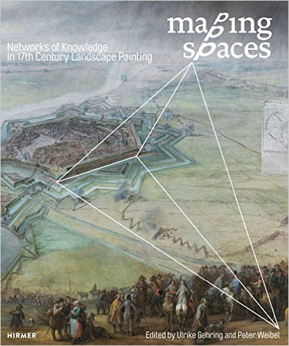
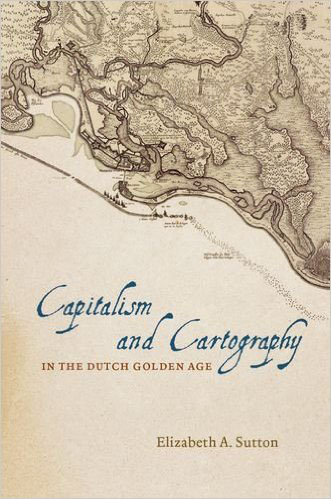
The two books under review offer distinct takes on the way space was understood and reproduced in the Low Countries (the Dutch Republic, in particular, although both volumes explore Flemish sources as well). Both are concerned with the production of space in two-dimensional forms—in maps, prints, and paintings, above all. And while the arguments and claims made by the respective volumes are not quite mutually exclusive, the implications and trajectories they sketch out are markedly different—heading, in fact, in nearly opposite directions. Elizabeth Sutton’s Capitalism and Cartography in the Dutch Golden Age looks backward to an earlier historiography and to debates of the previous (twentieth) century, if not earlier; framed by self-conscious flights of “theory,” her chapters endeavor to explain how “Dutch” culture worked in the “Golden Age,” as evidenced by a specific, fairly narrow set of maps. By contrast, the authors featured in Mapping Spaces: Networks of Knowledge in Seventeenth-Century Landscape Painting—this pertains especially for Ulrike Gehring, who composes the tour de force that is the opening chapter, which serves as an introduction to and overarching argument for the volume—look resolutely forward in terms of methodology and sources, offering a wholly innovative and revisionist approach to the “creative exchange between the arts and . . . scientific thought” in the early modern Netherlands (as the editors phrase this in their blurb). Mapping Spaces sets the agenda for future work: on landscape painting, on various forms of visual mapping (including cartography), and on new ways of representing space in early modern Europe.
Sutton’s slender volume—with barely a hundred pages of text (excluding notes and illustrations), it approximates what the Dutch would call a boekje—promises the reader a study of “capitalism and cartography in the Dutch Golden Age,” a salutary agenda, to be sure, yet one that might seem a bit vague and perhaps impossible to realize. Her title evokes Kees Zandvliet’s Mapping for Money: Maps, Plans and Topographic Paintings and Their Role in Dutch Overseas Expansion during the 16th and 17th Centuries (Amsterdam: Batavian Lion International, 1998), a classic study of Dutch maps, town plans, coastal perspectives, and landscape paintings in the seventeenth century; and it sets the reader up for some manner of elaboration on or revision of Zandvliet’s nearly two-decades-old analysis of how maps, in their myriad forms, fit into Dutch commercial culture. Sutton, however, moves in another direction: not toward the deep archival work of Zandvliet or the business of cartography in the Netherlands, but toward the Marxist scholarship of an earlier era and assertions meant to illuminate what she terms “a preeminent capitalist nation in the early modern global world system” (1). “Nation” is not defined by the author, nor in any concrete way is “capitalism.” By the somewhat redundant phrase “global world system” she means to engage with the work of the sociologist Immanuel Wallerstein, who published his seminal research in the 1960s and 1970s. Sutton also invokes (and quotes at length) Anthony Giddens, Charles Tilly, Max Weber, and Karl Marx; yet these theorists of capitalism and labor are dutifully trotted out in the introductory chapter only to recede into the background for the remainder of the book. This is a study prefaced by “theory,” yet otherwise uninterested in the theoretical work of cultural historians and historians of science (lately focused precisely on the commercial aspects of knowledge production). Strikingly, too, there is scant engagement with art history and with visual matters (Svetlana Alpers’s canonical essay on “The Mapping Impulse in Dutch Art” barely merits mention [Svetlana Alpers, “The Mapping Impulse in Dutch Art,” in The Art of Describing: Dutch Art in the Seventeenth Century, Chicago: University of Chicago Press, 1984, 119–68]), let alone media studies and the excellent recent work on the so-called material turn (another fruitful way to study maps, which so often served as decorative objects in Dutch interiors).
Rather, Sutton’s book, its ambitious title notwithstanding, offers a set of case studies that spotlight the work of Claes Jansz Visscher, an early seventeenth-century printer and mapmaker who owned a shop on the Kalverstraat in Amsterdam and whose heirs carried on the family business (as was common for Dutch mapmaking clans) into the early eighteenth century. Her argument is that Visscher’s maps reflect the politics of his time and place—“capitalism” in the “Dutch Golden Age”—and, more particularly, the power and dominance of the regent class of Holland. Chapters highlight Visscher’s early seventeenth-century View of Amsterdam (not, in fact, a map) and maps showing the Beemster land-reclamation project (an investment project, thus capitalism); mid seventeenth-century maps of Brazil, some made by Visscher yet more often the products of the prestigious Blaeu atelier; and a chapter on New Netherland, which explores not so much cartographic or visual matters as colonial politics and a well-known (textual) description of the colony by Adriaen van der Donck. Maps are broached throughout these chapters, yet they are mostly seen as reflections of other social and political phenomena: they demonstrate the power of the regents, the interests of the merchant class, the imperial strategies of the Dutch West India Company, and so on. They do not prompt questions about production—one wonders about workshop practices and marketing strategies, not to mention graphic techniques and other matters related to the actual making of maps, which are among the central concerns of Mapping Spaces—or about the consumption of cultural artifacts that were, after all, material objects collected and displayed in a variety of settings that extended far beyond the merchant or regent class.
Sutton’s broadly argued thesis that maps denote power—this was the key insight of Brian Harley’s revisionist work in the history of cartography, again going back to the 1970s—is overly simplified. It takes away any sense of agency from the map producers, the map consumers, and the maps themselves. And it prompts several questions, which are either overlooked or inadequately handled in this brief book. These questions problematize precisely the connections between production—the work of surveyors and engineers (these are taken up marvelously in Mapping Spaces), of mapmakers and map publishers (discrete categories that Sutton all too often conflates), and, of course, of draftsmen and artists (somehow, and paradoxically in a book by an art historian, almost entirely neglected)—and consumption. How does one account for the market for early modern Dutch maps—surely a central concern for a study focused on capitalism—which extended well beyond the regent class that Sutton is keen to highlight? (Dutch maps were relatively inexpensive and accessible; ownership was notably widespread.) If a map of Brazil reflects the interests of the noble-born, colonial governor who commissioned it—in this case, the humanist prince, Johan Maurits of Nassau Siegen—how does one reconcile these with the adamantly commercial-oriented agenda of the Dutch West India Company? (The two parties clashed throughout the period surveyed by Sutton, as the interests of the prince—reflected in the maps, Sutton proposes—rarely matched those of the West India Company directors, who eventually recalled him.) Most critically, how does one make a case for the Dutchness of these maps and their commercial-cum-capitalistic semiotics when they sold so well beyond the borders of the Netherlands? For the maps of Visscher and Blaeu became veritable standards throughout Europe, marketed to a non-Dutch audience and otherwise copied by various non-Dutch mapmakers. More to the point, the patterns of mapmaking that Sutton identifies—maps celebrating the city, the “nation,” the empire—were readily found in Britain, France, Spain, and elsewhere where early modern cartography flourished. How is the case of putatively “Dutch” “capitalism” distinctive?
It is precisely the Dutchness and cartographic qualities of these artifacts—the forms of the maps themselves—that are left unexamined. While time and space are Sutton’s analytical tools, she does not ultimately deploy them to investigate the innovative mapping techniques that developed in the early seventeenth-century Low Countries: the new ways of making and knowing space at the very moment when space was being energetically made—literally made, in land-reclamation projects—and when knowledge of space was being imaginatively expanded. These topics are meticulously treated, by contrast, in Gehring and Peter Weibel’s dense and rewarding volume, which approaches maps not so much as passive reflections of society but as active ways of knowing through spatial forms. Their book presents something of a hybrid between a catalogue—an exhibition of the same name took place at the Center for Art and Media Karlsruhe in 2014—and a broad-ranging assemblage of essays on the topic. It brings together art historians, historians of science (and historians of philosophy, economics, literature, and so on), geographers, mathematicians, and even theologians to explore how space was perceived and then imaginatively reproduced in two-dimensional forms in the early decades of the seventeenth century. The sum total of these efforts is a wonderful blend of art and science—of careful examination of images, resourceful use of archives, deep expertise across multiple disciplines, and “networks of knowledge” in the best sense of that often overused expression—that demonstrates how the productive and creative exchange between the arts and contemporaneous scientific thought led to a revolution in early modern mapping. Mapping Spaces provides nothing short of a brilliant historical analysis of spatial innovation.
The narrative of this innovation—a dramatic story of technical advance (engineering plays a big role) and visual experimentation—is cogently and thoroughly laid out in Gehring’s lengthy opening essay, which presents a superb study of “the opening up of [early modern] pictorial space” (24). This is traced through an eclectic range of sources, including navigation handbooks, marine painting, various forms of landscape prints and paintings, and, of course, cartographic renderings of the earth (both land and sea). Gehring is profoundly interested in how space was studied and reproduced: how artists and a broad cast of characters who might fall under the (admittedly anachronistic) rubric of “scientists” contributed to an ongoing exercise of conceptualizing and graphing space. She brings the reader into the prince’s court and the scholar’s classroom, as well the guildhall and the workshop, where readers meet theorists who cogitate on geography, mathematics, and natural philosophy, along with practitioners who labor as navigators, surveyors, and military engineers. In fact, among the key contributors to this story are military surveyors, who sketched battlefield scenes, laid out siege strategies, drafted engineering schemes, and so on. Gehring shows how these dirt-under-the-nail types—William Shakespeare’s “rude mechanicals”—developed forms of knowledge that were ultimately used by artists to narrate space. She grants a central role in her story to the otherwise not-well-known Pieter Snayers, a Flemish court painter in Brussels who specialized in the subgenre of historical battle scenes (typically painted after the fact to illustrate the military feats of the victor). And she demonstrates the transformation of a “multi-perspective view of space,” as developed by Snayers and other Flemish artists who wished to represent the various-staged battle scenes, “into a homogeneous spatial continuum” (24), which was expressed by better-known Dutch artists later in the seventeenth century. This transformation supported “the synthesizing of space,” which was so successfully achieved by landscape painters in the later seventeenth century (her exemplary case is Jacob van Ruisdael).
Gehring’s rich and imaginative essay serves as the volume’s opening and agenda-setting chapter. It is carefully argued and expansively demonstrated (it nearly matches in length Sutton’s book), and it is supported by ample visual and textual evidence. It provides both an introduction to the exhibition in Karlsruhe, which assembled a wide-ranging group of images and objects pertaining to mapping and space, and to the volume’s thirty-six essays. The latter tend to be brief case studies that serve either to introduce a particular object or image from the exhibition, or to extend and nuance Gehring’s argument—there are several essays, for example, on the spatially oriented “program” of study (and research) that developed in Leiden, which enlisted geographers and “engineers” (again, an anachronistic rubric) to solve theoretical and practical problems pertaining to the representation of space. (This focus on Leiden suggests, inter alia, a fairly obvious non-capitalistic venue for cartography.) These essays, along with Gehring’s, suggest fresh and innovative ways to think about mapping and “the opening up of pictorial space”; about the distinctive (and typically overlooked) genre of early seventeenth-century battle-scene paintings; about the spatial breakthrough that took place in Dutch landscape painting later in the century; and much more. They offer innovative approaches to early modern technologies of space—they introduce readers to a “culture of engineering” that shaped military spatialization—and to epistemologies of space, which derive (as Gehring elucidates) from early modern “mechanical” texts (she, like Sutton, takes up the work of the military engineer Simon Stevin). And in the end, they also offer a new way to think about mapping: less as a simple reflection of “capitalism” than a far richer engagement with ways of seeing and knowing the world.
A final note and one more distinction to be made between the two volumes under review: Mapping Spaces is a beautifully produced book, creatively laid out and excellently edited, and it is also a pleasure to read. It illustrates superb production values, and it prices remarkably well. Capitalism and Cartography has mostly cramped reproductions, none in color; it is a challenge to read this book as a work of “art” history. The University of Chicago Press might have done a better job of editing the often awkward, jargon-laden prose. Kudos, by contrast, to Hirmer for bringing out such a lucid and lovely volume and to Gehring and Weibel for assembling the fabulous images and essays that fill it.
Benjamin Schmidt
Giovanni and Amne Costigan Endowed Professor, Department of History, University of Washington

